How far would you travel just to see a single waterfall or hike a scenic path? A hundred miles? More? In the Portland metro area and eastbound 100 miles or so those extremes are not needed; the Columbia Gorge provides easy access to a wealth of views for all who live in the region.
In part one, I began the tale of an afternoon excursion my wife and I made up the gorge last fall, leaving off at Bridal Veil Falls. But we were just getting warmed up. Folks who get excited about seeing one waterfall better take a chill pill, they might O.D. on today’s offering.
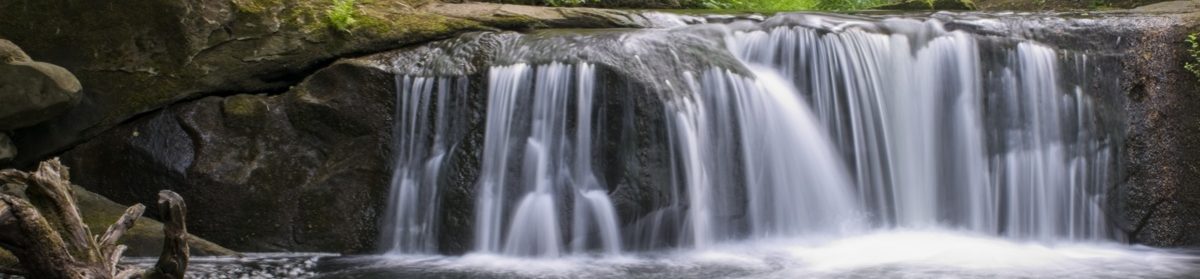
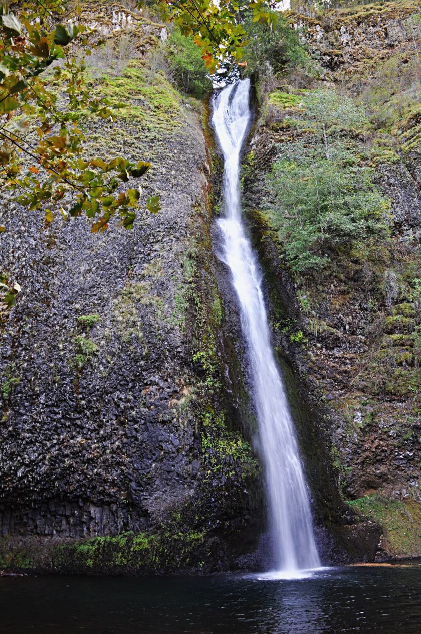
Wahkeena Falls
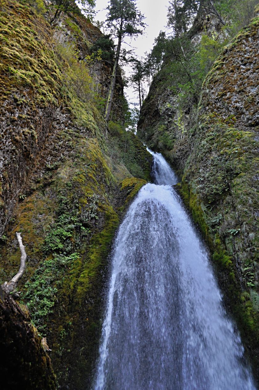
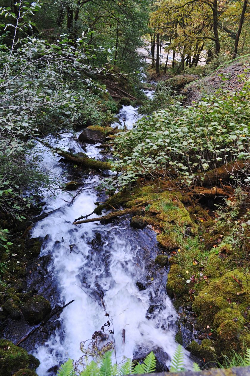
A couple miles east of Bridal Veil is Wahkeena, a falls that didn’t know what it wanted to be when it grew up, so it became several things. The lower section is a long cascade, merrily tumbling down a rocky streambed to the scenic highway and beyond.
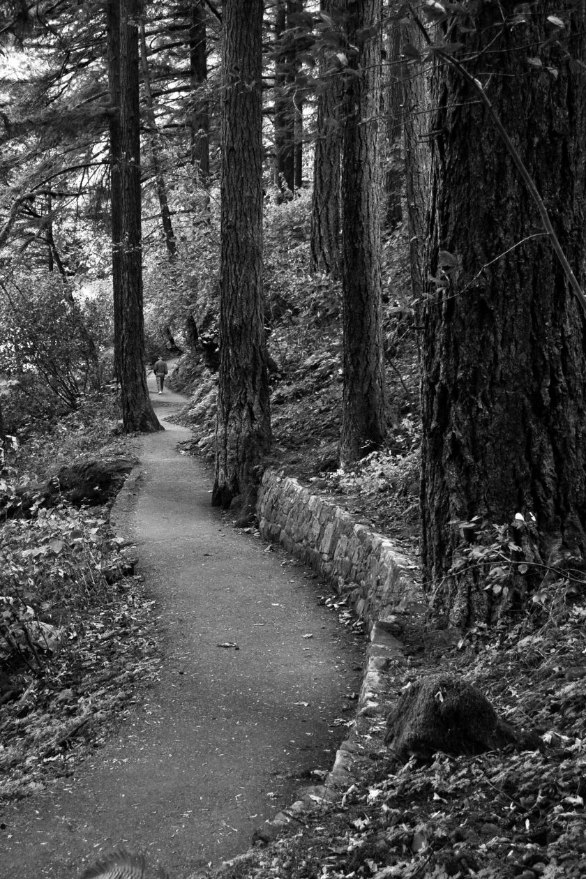
Like other falls in the gorge, Wahkeena has a nice hike you can enjoy. It’s a short one, a 1.4 mile round trip to the top of the falls, or if you want to go easier just hike to the top of the cascade to a bridge at the bottom of the main falls – that bit’s only .4 miles up and back. But don’t get too cocky, it’s an 850 foot elevation change to the top and you may need to fire up the huff and puff machine.
Although the falls are nice, the trail’s not too shabby either.
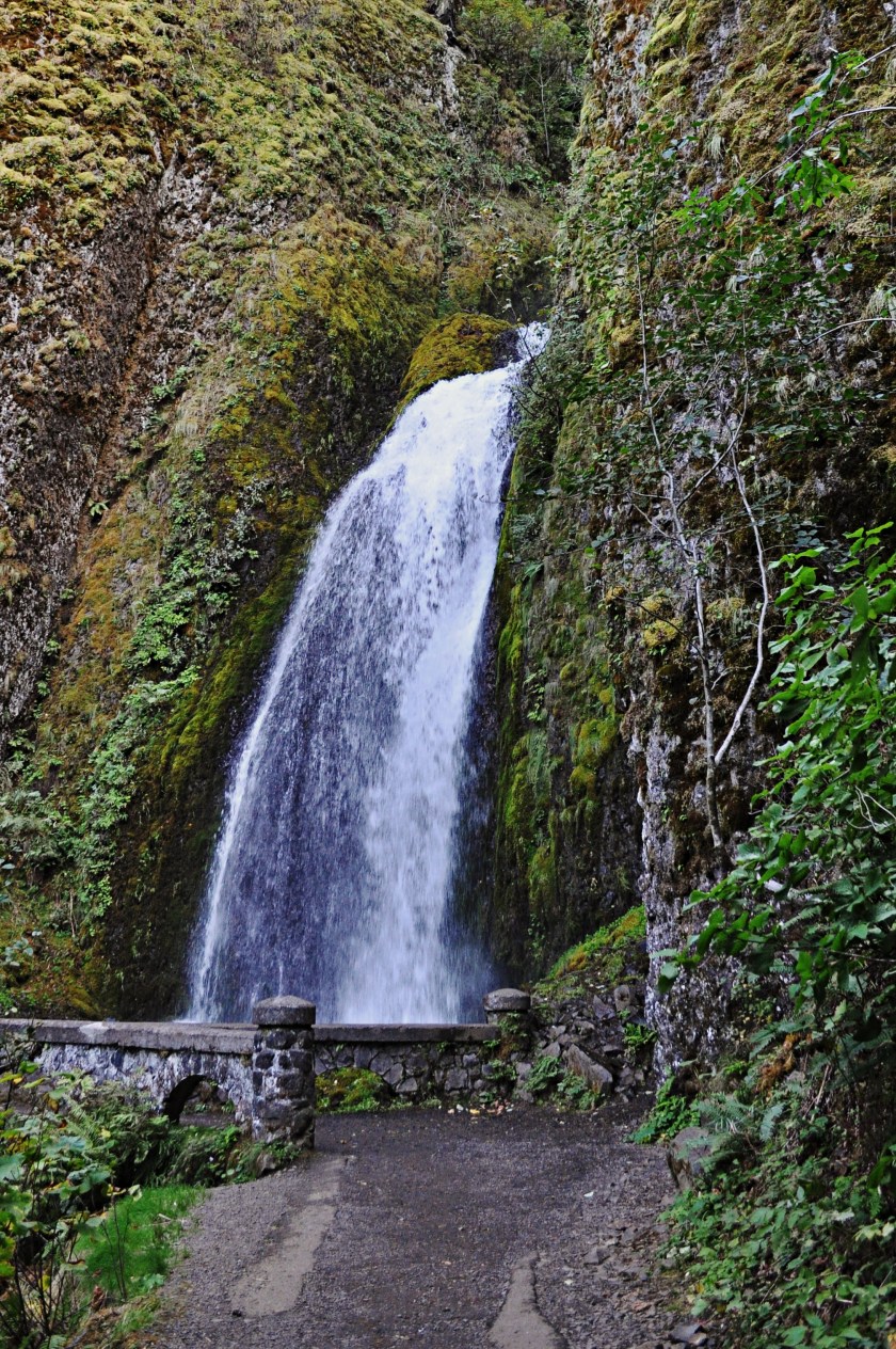
The falls itself is a 242 foot double dipper. If the cascade is a shimmy, this falls takes two bows.
Since we were hitting multiple stops, we opted for the short hike to the base of the falls and back.
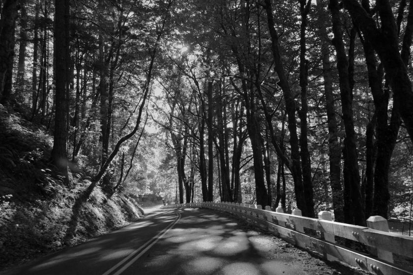
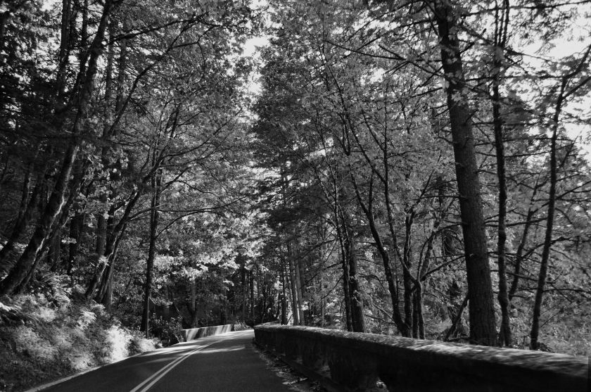
Something I haven’t mentioned about the Northwest: we grow our trees tall out here. It makes for nice shady trails. Nothing like being in the shady part of town on a warm day.
Wahkeena is only about a half mile from Multnomah Falls, and there’s a trail spur that heads off that way. We declined using the spur and took a different sort of horse down the scenic highway to Multnomah Falls.
Multnomah Falls
As mentioned in part one, at 620 feet Multnomah Falls is the second highest year round waterfalls in the United States, so it’s no surprise that it’s tourist magnet. As we came via the scenic highway we didn’t have to play the same parking lot lottery the freeway drivers do, there’s a separate lot next to the lodge, but parking can still be an adventure.
The lodge was built in 1925, but doesn’t support overnight accommodations. In addition to the bodacious view in its backyard it has a restaurant, snack bar, and gift shop, so it keeps the drive by tourists happy.
At least I think it has those features, I haven’t stuck my nose inside for years. I can vouch for the snack bar, after all the previous activities of the afternoon the hot dog and Coke, and a hot chocolate for my wife was very tasty.
When 620 is mentioned as the height of the falls, an asterisk is needed. Like Wahkeena, Multnomah sheds a couple tiers. The first big tier drop is 542 feet, followed by a short river run with a 9 foot decline, then a 69 foot drop.
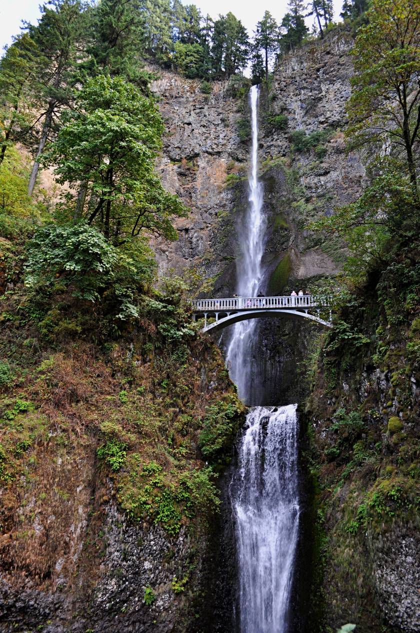

Naturally there’s a trail, and it’s paved to stand up to the mob on a rainy day. A good amount of the tourists don’t go beyond the lodge’s observation deck, but for those with a least a little get up and go the bridge over the lower falls is only 2/10 mile, and the incline is mild. For those up to a little more effort, you can hike up to an observation deck at the top of the falls, a 2.6 mile round trip with a 700 foot elevation gain. This section follows a bunch of switchbacks, some of which open up to great views of the Columbia river and the gorge. The elbows on the switchbacks are popular resting places so you don’t have to get stuck behind weekend warriors.
Now for the good part. If you’ve made the effort to get to the top of the falls, there’s another section of trail that you can continue on all the way to Larch Mountain. I borrowed a passage describing that epic walk:
How do we describe this hike? It’s a 2/10 mile paved stroll for an elderly woman with a walker. It’s a grueling one mile uphill battle shoving a baby stroller. It’s a quiet walk next to an incredible stream filled with rapids and waterfalls. It’s a five hour, 4000 vertical foot exhausting climb to the most beautiful view in the area. It’s anything you want it to be. It just depends on how far you go.
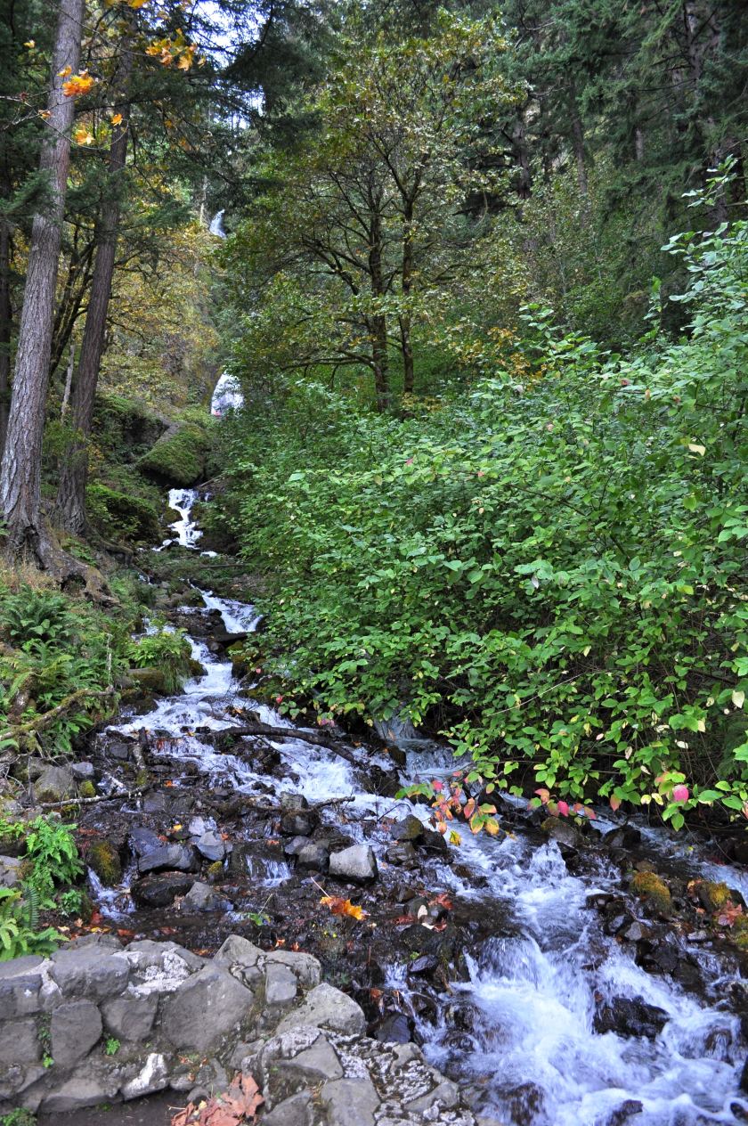
When I was a younger man I made that exhausting climb to Larch Mountain, and learned how exhausting the return can be as well – it’s a 14.4 mile round trip. I can’t say I recommend the full route for the casual hiker, but note the “quiet walk next to an incredible stream filled with rapids and waterfalls.” I strongly suggest, should you have hiked to the top of the falls, get off the paved trail, hang a left and follow the river for another mile or three. You will not regret it. I’ll show you some of that section in part 3.
Of course on this particular day we wussed out and didn’t even emulate an elderly lady with a walker. We just continued onto Oneonta Gorge.
Oneonta Gorge
A couple more miles up the scenic highway we came to Oneonta Gorge, a narrow canyon split with a river running through it. Perhaps Oneonta Chasm would be a better name.
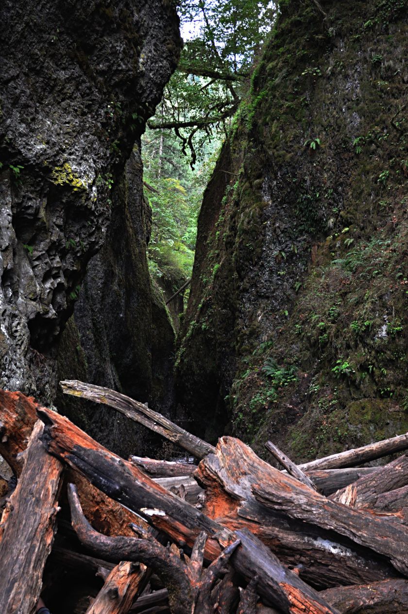
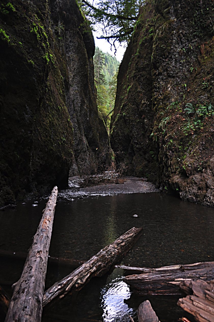
Oneonta Gorge has a couple of related trails, but the primary one is a tad unconventional: you have to hike up the river. But first, you have to scale a pretty significant log jam – maybe 15 feet high, a massive jumble that spans the width of the chasm. This log jam is a relatively recent occurrence, it showed up in the mid to late 90’s. We did have some flooding in the region in that time frame, it would have been spectacular and probably frightening to see that jam form, even from a safe vantage point.
Once you get past the jam you’ll need to get wet to get to the end of the gorge. Your hike will take you into cold water that gets as much as chest high, but about a half mile in the chasm finishes with yet another waterfall. I’ve haven’t gone to the end myself, and how far in you can go without getting wet has varied over the years.
Horsetail Falls
Another 1000 feet or so beyond Oneonta Gorge we got to the final falls in our excursion, aptly named after the broom on the south end of a horse.
The 176 foot falls itself is just off the road so no real hiking is needed to see it, but being the gorge there is a trailhead there too, the Horsetail Falls loop. This loop runs 2.6 miles, and includes three waterfalls: Horsetail, Ponytail, and the top of Lower Oneonta Falls (the one at the end of the chasm.) Occasional views into Oneonta Gorge are also present. You can also connect to another trail that goes to Triple Falls, a cliff with three separated falls dropping over.
There are more trailheads in the gorge than just those near waterfalls, and many of the trails have junctions with other trails, creating a network of paths you can take. Anybody who can’t find a good hike in the gorge, albeit one you may need to share with a few people here or there, might as well punt and move to Outer Siberia.
Another mile and a half up the scenic highway took us to an interchange for the freeway for the return trip to Portland and the end of our excursion.
But the gorge continues on. Heading further east to Hood River gets you into windsurfing country. From there you can take a scenic loop south towards Mt. Hood, or continue east towards The Dalles. Heading east the complexion of the gorge and the area starts changing, it goes from green and lush to brown and dry, creating a different sort of beauty.
By now it should be clear, although our afternoon excursion brought us to a plethora of stunning views, we were just skimming. The gorge is full of excursions, and gorge-ous views abound.

Really nice photos 🙂
LikeLike
Thanks! It was fun picking them out and tweaking them a bit.
LikeLiked by 1 person
Great Post
LikeLike
Thanks
LikeLiked by 1 person
welcome
LikeLike
Beautiful! I may have to add Oregon to my must-see destinations. Thank you for sharing!
LikeLiked by 1 person
Yep, it’s worth seeing. Glad you enjoyed it.
LikeLike
Next time I am out that way…
LikeLiked by 1 person
The coast is pretty nice too, should you make it out.
LikeLike
Well, the Portland area is now on my to-do list (even more so than after i read your previous post). The photos are absolutely lovely. I can’t help but enjoy a waterfall.
LikeLiked by 1 person
That seems to be a popular refrain. Summer/early fall is the best time, unless you actually like our natural sky color: grey with occasional rain. It’s green out here for a reason.
LikeLiked by 1 person
Aaah so beautiful 🙂
LikeLiked by 1 person
Yes, we’re pretty lucky around here. There’s a lot of beauty in the Philippines as well, and I’ve only seen a little bit of it.
LikeLiked by 1 person
Wow, Dave. Almost worth flying out from UK just to see those!
LikeLiked by 1 person
That would be quite a switch from seeing India again. 😉
LikeLiked by 1 person
It would, but your pictures look pretty damn good!
LikeLiked by 1 person
And there’s more to see in the Pacific Northwest than just the gorge.
LikeLiked by 1 person
Oh, so much to see, so little time and money!
LikeLiked by 1 person
They all look great, but I’d particularly like to see Multnomah Falls. They really do look very impressive. 🙂
LikeLiked by 1 person
Multnomah Falls is the most impressive of the lot. It’s more beautiful from the bottom, but if you go to the viewing deck at the top you get a real appreciation for the size of the drop.
LikeLiked by 1 person
It sounds like another place well worth visiting. 🙂
LikeLiked by 1 person
Pretty good post with real good pics. 🙂
LikeLiked by 1 person
Thanks!
LikeLiked by 1 person
Remarkable photos of this magnificent place! We were there last year, hope to go back soon 🙂
Thank you for sharing!
LikeLiked by 1 person
Thanks Amy. It is kind of amazing how much beauty is concentrated in one area.
LikeLike
What a great overview — and wonderful photos! Keep up the great travel blogging!
LikeLiked by 1 person
Thanks Bruno. I’ve been enjoying your site as well.
LikeLike
Oneonta isn’t just “cold,” it’s the kind of temperature that erases all memory from your privates. I wax poetic:
https://allthoughtsworkoutdoors1.wordpress.com/2006/09/04/13-hiking-tips-for-the-lower-oneonta-falls-virgin-9-4-06/
LikeLiked by 1 person
That’s an awesome write up. Mandatory assignment for anyone who’s made it to this section of comments: go read that post. Now.
LikeLike
Dave, the check’s in the mail….
LikeLiked by 1 person
It all looks absolutely beautiful.
LikeLiked by 1 person
It’s definitely one of the nicer places in the world.
LikeLike
I’m looking at all your waterfall posts, little by little, I guess saying “Wow!” isn’t particularly original, but Wow! One set of my grandparents went out to Oregon/Washington years ago, and talked about the waterfalls, but they were not photographers and the videos were mostly of their feet, crossing parking lots, the inside of the glove compartment, etc.
I wondered about the gorge named Oneonta, there’s a town in NY, south of Cooperstown (Baseball Hall of Fame) , and sure enough, there’s a connection, the fella who named it was from that town. Oneonta is OK, on the upper Susquehanna and kind of the edge of the Catskills, but no waterfalls, nothing as beautiful as this area you photographed.
LikeLiked by 1 person
Now that you’ve seen some of the waterfalls and scenery in the gorge, you can get a better feel for the tragedy of last year’s wildfires in that area. It’s all still closed off except for Multnomah Lodge, and even there the trails are still closed. All areas require maintenance, and for some trails it’ll likely be years before full access is available. Oneonta Gorge was one of the harder hit places. 😢
LikeLike
😦 so sorry. I guess it was unusually dry for you folks, that’s such a shame.
LikeLike